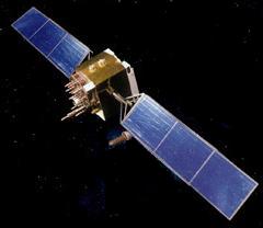
| The Global Positioning Satellite System is a space navigation system operated by the United States Air Force Space Command. It is available for military and civilian use, and at the present time is the most widely used navigation system in the world. A minimum of 24 satellites are maintained in near circular semisynchronous orbits spread over 6 different orbital planes. | |
GPS TRANSMIT FREQUENCIES
| Channel | Frequency/MHz | Use | Comments |
| L1 | 1575.42 | Civilian | C/A and P codes |
| L2 | 1227.60 | Military | P code |
| L3 | 1381.05 | NUDET | Nuclear detonation detection |
| L4 | 1842.40 | Ionospheric Correction | Minimal ionospheric delay |
| L5 | 1176.45 | Civilian | Second civilian channel |
| S1 | 2227.50 | Telemetry | Satellite systems monitoring |
Notes:
1. Not all satellites use all the frequencies listed above. Early satellites in the series transmitted only the L1, L2 and L3 channels.
2. C/A stands for coarse acquisition code, P stands for precision
code.
3. Information is impressed (modulated) on the respective carrier
signals using spread spectrum techniques. Pseudo-random code
sequences are used. The C/A (coarse/acquisition) modulation
has a repetition length of 1023 bits, and the modulated bit rate
is 1.023 million bits per second, thus repeating the code in
one millisecond. The P (precision) modulation has a
pseudo-random code length of six trillion (6 x 10¹²)
bits and a modulation rate ten times that of the C/A code. The
C/A pseudo-random sequence is widely available (clear access),
whereas the P sequence is restricted to selected users.
Superimposed on the C/A and P codes is a low data rate (50 bps)
modulation which transmits information about the satellite
ephemeris, clock and other corrections and information about the
status of both the particular satellite and the GPS system.
4. GPS carrier frequencies are an integral multiple of the
high speed (P code) chip rate:
Satellite Orbital Data:
Notes:
Satellite Timing:
Ionospheric Effects Data
The ionosphere is a plasma existing in the upper atmosphere
between the approximate altitudes of 80 to 800 km. Radio
waves passing through this plasma will be retarded (slowed
down). The amount of retardation may be expressed in terms
of time or equivalent range. It is proportional to the
columnar electron content (electrons per square metre) of the ionosphere and the inverse square of the signal
frequency. The total electron content [TEC] between the
satellites and ground is typically between a few and several hundred TECU
where 1 TEC Unit = 1016 electrons/m2.
Specific timing and ranging errors for different TEC values
are specified at the L1 GPS frequency in the table below.
| TECU | Range Error(m) | Time error(ns) |
|---|---|---|
| 1 | 0.163 | 0.542 |
| 10 | 1.63 | 5.42 |
| 100 | 16.3 | 54.2 |